WinGPS 5 Voyager is the sailing version of our WinGPS Navigator and Pro. Laptop navigation with the WinGPS 5 Voyager: The extensive navigational program WinGPS 5 Voyager is developed specifically for and with sailers and helps you sail sharper and faster. Your sailing will be optimised – to win races. |
 From € 399,-   |
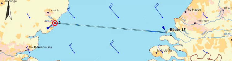
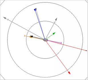
| Choose your polar diagram In WinGPS 5 Voyager more than 4000 polar diagrams are available. Choose one of these polar diagrams, download the latest GRIB files and plot your desired route. WinGPS 5 Voyager will help you by optimizing your route. 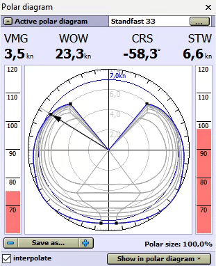 For even better results you can connect an anemometer to your laptop and use the actual wind within the polar diagram. Recording your own polar diagram is also possible with the help of an anemometer. Great when the polar diagram for your ship isn’t available! What is a polar diagram? This is a table (see right) with all the optimal sailing speeds of a specific ship at certain courses and wind speeds. While sailing you can immediately check if you reached the optimal speed, or if you need to trim your sail a little bit. https://www.stentec.com/en/news/route-planning-with-wingps-5-voyager
Wind, currents, waves and water heights
From Team Stentec Navigation www.stentec.com tel: +31 (0) 515 – 443 515 |