Rule of twelths? It’s a bit tricky when using metric charts… so use the Rule of Tenths, As your on-deck ready reckoner for the currrent state of tide.
By Dan Houston
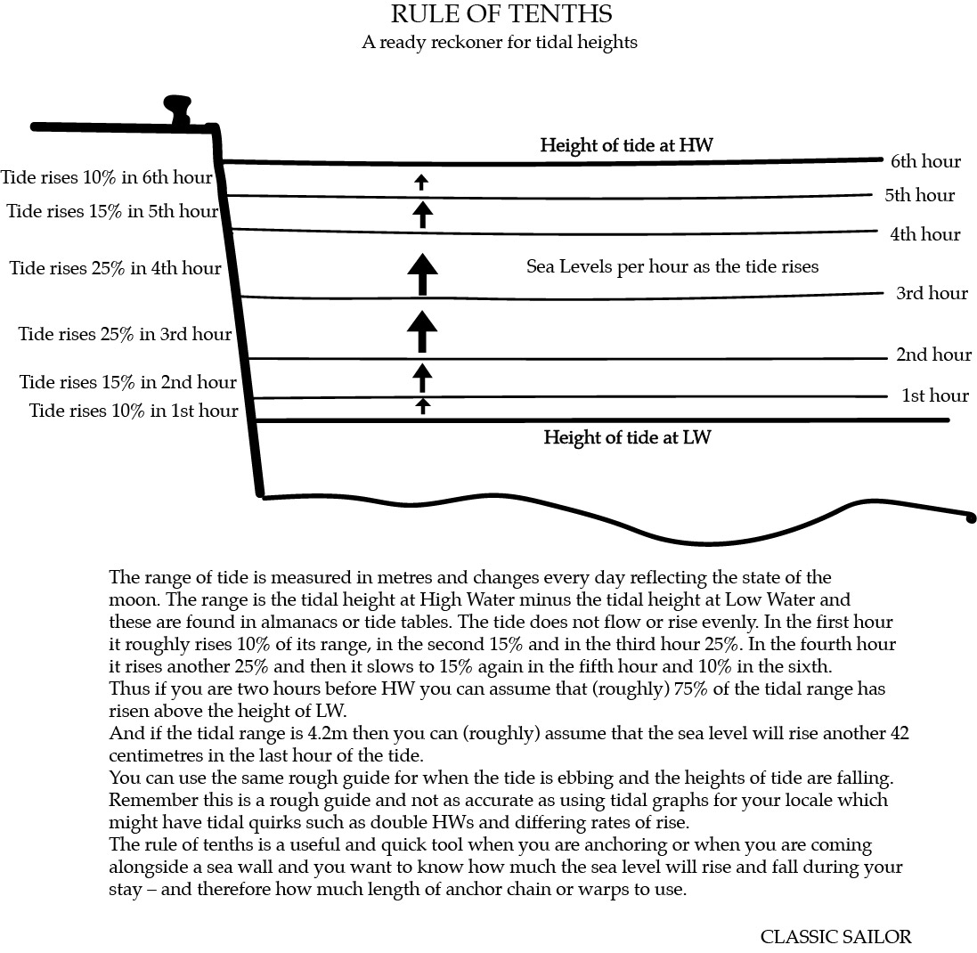
Working out tidal heights using the traditional rule of twelfths is easier if you convert it to percentages that can be used with metric tide tables. The old standby – the rule of twelths, which worked well with charts featuring depths in fathoms, uses the rough premise that tide rises one twelfth of its range in the first hour, two twelfths in the second; three in the third; another three in the fourth; two in the fifth and slows down to the last twelfth in the sixth. But using percentages the system is easier to use with metric heights of tides and charts. Thus the rule of tenths goes like this:
1st hour 10%
2nd 15%
3rd 25%
4th 25%
5th 15%
6th 10%
If you are an hour before high water then you can expect the tide to have risen about 90 per cent of its range (or 11 twelfths). Say the range for the day is a Dover spring tide of 5.9m. Simply taking 0.59 (10%) from the range leaves less room for error than taking off a twelfth, albeit the answer is roughly the same. Often there won’t be much advantage over working with twelfths especially if you call your Dover spring 6.0m or have any other figure that’s easily divisible by 12 – and remember this is a rule of thumb; ; it’s not meant to be highly accurate. And it should not replace using a tidal curve to work out how much water you have now; how much the tide will rise and how much it will fall.
For accurate tidal work you should always use a graph (tidal curve) – especially in places like the Solent where the tidal curves, standing high waters and so on make the rule of tenths, or twelfths far less accurate.
The tide runs and rises for roughly six hours on the flood and then six on the ebb. So typically there are two High Waters in a day and two Low. Unsurprisingly tide runs and rises fastest in the middle hours of its cycle – which the figure below shows. To use the rule you need the time now, the time of HW, the range for the day (difference in metres between High and Low water) and a basic ability with maths. (Remember the height of tide is not the depth of water, charted depth will usually be greater, but could be less if you navigating over drying heights.)