From Stentec Navigation: Great news for all sailors who plan trips on the great open waters. The NV Verlag charts for a.o. the Baltic sea are available in the 2019 edition. Some new chart sets were also added to our assortment.
Click here for a full overview of our NV charts.
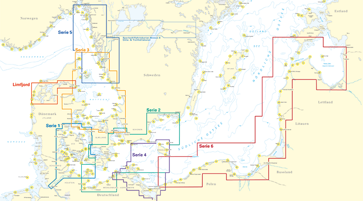
Baltic sea voyages
Thee popular Baltic sea charts are delivered as a combi pack: the paper chart set, a harbour plans and a download which allows you to install the charts in WinGPS 5.
For voyages to the Baltic sea we recommend the DKW 1800 series and the DKW German Bight. These are both updated weekly, connect seemlessly and and will connect to the NV-Verlag Series 1 chart set.
Updates on other charts
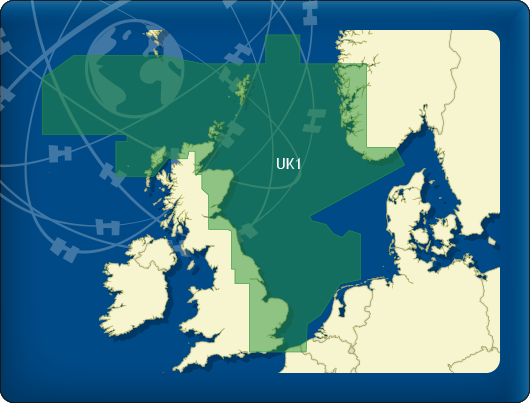
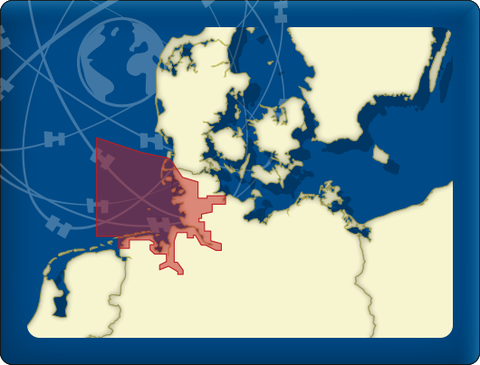
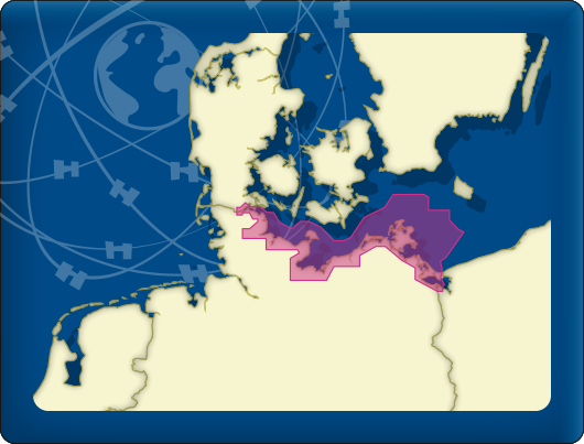
The 2019 editions for DKW UK1 English & Scottish East coast, DKW German Bight and DKW German Baltic coast are available in our online shop. When you purchase one of these 2019 editions, you will automatically receive all updates for the whole of 2019. You will receive weekly updates for the DKW German Bight! When you have a 2018 edition of one of the charts, you can buy the special upgrade version.
| DKW UK1 English and Scottisch East coast This year the charts received a new color scheme for a calmer chart view and some windmill parks have been removed. Also, a chart was added for the Tees Bay approach, for extra detail visibility (e.g. buoys, wind turbines).
|
 |
| DKW German Bight The charts have been updated with all NfS messages (German NtM) up until week 8 of 2019. Weekly updates will add all upcoming NfS messages. The windmill parks in the Weiße Bank are added on the chart and sector lights for Süderoogsand and Westerheversand have been modified.
|
 |
| DKW German Baltic coast Obstructions have been found in the Kieler Förde and have been added to the chart.
|
 |

Pre sale
When you purchased the DKW charts in pre sale, you can download the charts in WinGPS right now. In WinGPS 5 (Windows) you can update from the news center and in WinGPS Marine (Android) the update will be shown at start up. You will need a working internet connection to download the charts.
Team Stentec Navigation
www.stentec.com
tel: +31 (0) 515 – 443 515
 |
WinGPS 5 2019 available now! The navigational program for Windows, WinGPS 5, is now available in the 2019 edition. By purchasing this new edition and installing it on your system you are assured of the newest WinGPS 5, including all updates to the waterway network, bridges, locks and current & tidal information. When you have a Service Card 2019, you can download the 2019 edition directly from your Stentec-account.  |